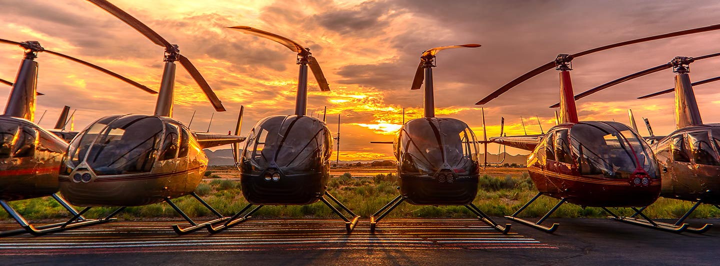
Precision Aerial Surveys and Visual Data Acquisition
Strategic Aerial Insights for Arkansas
For comprehensive aerial data acquisition across Arkansas, including advanced magnetometer and electromagnetic surveys, precision LiDAR mapping, and detailed GIS integration, Fort Smith Helicopter Charters provides diverse solutions. Helicopters inherently offer the unique advantage of low-altitude flight and stable hover capabilities, essential for capturing high-resolution data and intricate details. Furthermore, we facilitate specialized aerial filming services, incorporating cutting-edge cinematography and photography platforms, or providing aircraft configured for handheld operations with door removal. For discerning a comprehensive perspective over the Fort Smith metropolitan area or the wider Arkansas landscape, our capabilities offer unmatched versatility and technical depth.
Aerial
Surveys
LiDAR, GIS Maps, FLIR, HD Video & More
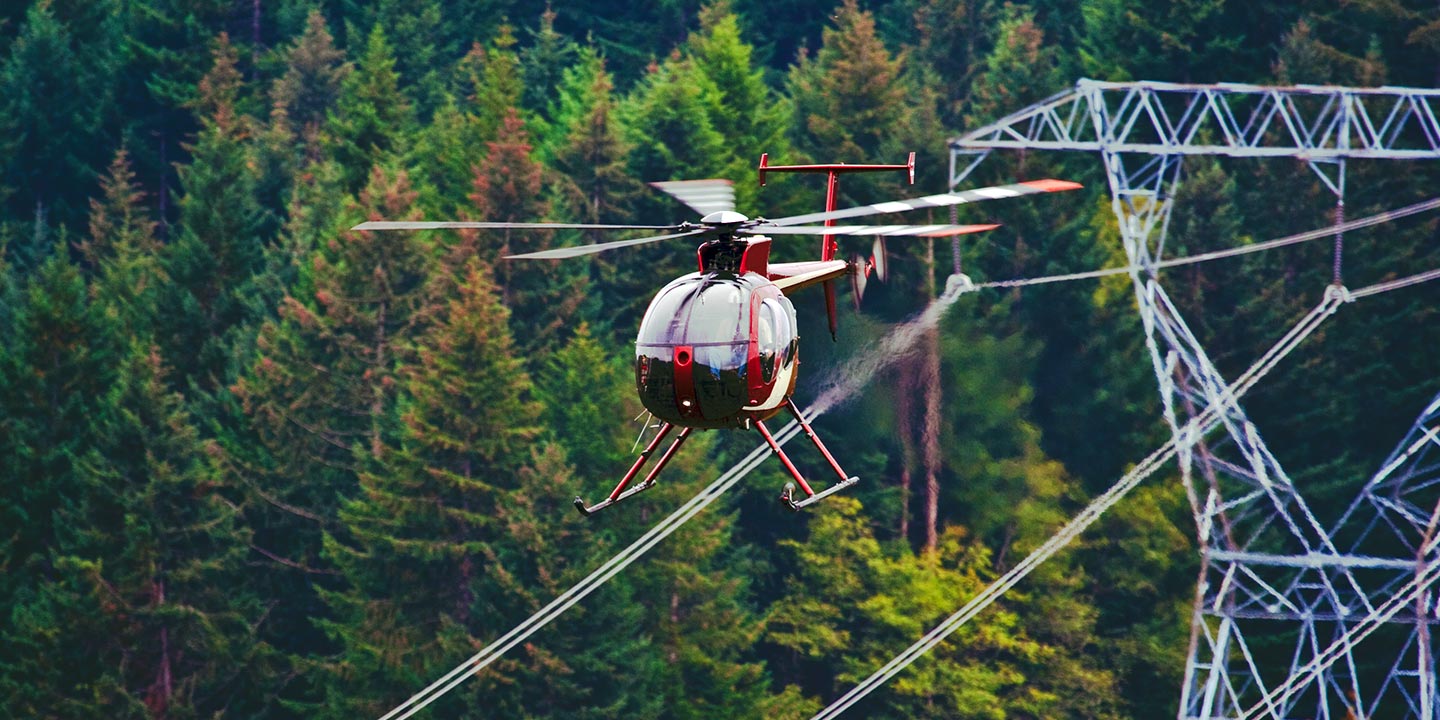
For critical infrastructure management, including pipeline integrity assessments, Right-of-Way inspections, and transmission line patrols, Fort Smith Helicopter Charters facilitates access to the precise aircraft and specialized equipment required. These operations are executed with the necessary expertise and precision to ensure comprehensive data collection and effective project completion across the diverse Arkansas terrain.
High Tech Results
The Top Pilots in Arkansas, Today's Technology... Maximum Results.
Call 1-866-826-4826 Now!
Fort Smith Helicopter Charters provides the tools needed to complete your land surveys, utilizing the right equipment to provide the aerial photos that are often needed.
An advanced aerial survey represents a cornerstone for efficient Right-of-Way and site inspections, precise topographical data acquisition, and high-definition imaging crucial for commercial development projects. Helicopter-based surveys offer a superior method for detailed examination of Arkansas' varied terrain, enabling proactive identification of pipeline anomalies, detection of transmission line infrastructure issues, and high-resolution visual documentation of properties. Fort Smith Helicopter Charters excels in developing bespoke photographic and remote sensing operations, engineered to optimize both technical accuracy and financial efficiency, delivering actionable insights for your strategic objectives.
The inherent operational characteristics of a helicopter, including its capacity for low-altitude, low-airspeed flight, make it the optimal platform for detailed aerial surveying. While fixed-wing aircraft are generally restricted by FAA regulations to altitudes of 1,000 feet above obstacles, helicopters possess the unique ability to operate at significantly lower altitudes. This operational flexibility also allows helicopters to access and thoroughly inspect challenging or hazardous zones, providing engineers and project managers with critical vantage points otherwise unattainable through ground-based or fixed-wing methods.
There is no better way to conduct your visual survey, animal population counts, soil drainage analysis, ROW inspections, pipeline and transmission line inspections, and geographical surveys.
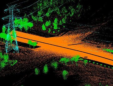
LiDAR Imaging
Light Detection and Ranging, or LiDAR, is a remote sensing method used to examine and measure Arkansas topography as well as objects, like vegetation, upon it.
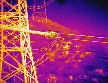
Infrared Imaging
Thermographic IR cameras are used to detect radiation in the long-infrared range of the electromagnetic spectrum and produce images of that radiation, called thermograms.
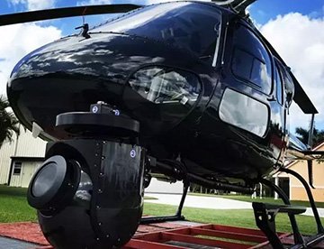
HD Video Gimbal Capture
Modern HD and 4K cameras can be mounted to helicopters, using the proper STCs, with a gimbal to stabilize photos & videos for detailed results.
Advanced Aerial Cinematography and High-Definition Capture
For expert camera work in the Fort Smith Sky
Get a Fast, free QuoteFort Smith Aerial Cinematography
Fort Smith Helicopter Charters provides access to a comprehensive suite of resources essential for professional-grade aerial cinematography across Arkansas. We facilitate specialized aircraft configurations equipped with advanced gyro-stabilized camera mounts, such as Tyler Mounts, Wescam, Cineflex, Pictorvision, and SpaceCam, integrated with industry-leading cameras including Cineflex HD, RED Epic, and Arri Alexa, supporting both conventional and experimental 3D capture. Our services extend to all facets of production, from dynamic air-to-air sequences to precise ground-to-air shots. We ensure optimal visual outcomes through meticulous coordination with your aerial Directors of Photography and directors. Specializing in helicopter support for both still and motion photography, Fort Smith Helicopter Charters addresses a wide spectrum of media production requirements throughout Arkansas, encompassing film, television, documentaries, promotional videos, commercials, aerial props, and comprehensive coverage for major sporting and historical events, utilizing a diverse fleet of helicopters.
Call Us Today at 1-866-826-4826 for a Free Quote
Contact Us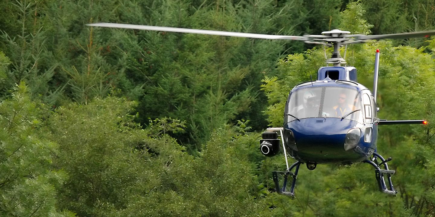
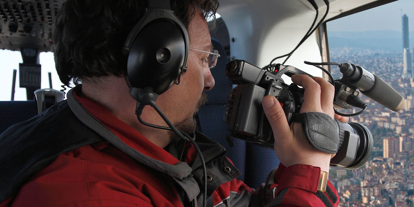
Aerial Photos
Hand-held or Mounted OpTions in Fort Smith
We will help you get the right equipment for your aerial photography project! Call 1-866-826-4826 today to get a fast, free quote.
The Most Options for Photography
The visually rich landscapes and distinct geological features of Arkansas are most effectively captured from an aerial perspective. Fort Smith Helicopter Charters specializes in facilitating aerial photography operations designed to meet precise client specifications, enabling the realization of specific visual content objectives. We offer competitive value for professional photographic services across Arkansas. Many helicopter configurations can accommodate door removal for handheld camera applications, and for projects demanding superior stability, information regarding advanced gyro-stabilized mounting systems is readily available to ensure optimal image quality.
Superior Service
Every one of our customers gets a dedicated helicopter expert to assist with flight plans, tech loadouts, production logistics, project schedules, and other demands.
Over 500 Aircraft
Our network of direct air partners extends well beyond Fort Smith, Arkansas. This allows us to offer a wide range of solutions for even the most sophisticated projects.
The Best Equipment
From high-tech sensors like LiDAR, FLIR, and GIS to HD cameras and movie production gimbals, we're here to make your job as easy as possible.